

























































For much of the early summer, Minnesotans enjoyed a rare reprieve from the apocalyptic, orange-hued horizons that defined the previous few years. The air was clear, the skies were a crisp, summer blue, and the familiar scent of woodsmoke—a staple of recent Midwestern summers—was absent.
That fragile sense of normalcy shattered this week. A combination of lightning-induced ignition in the Superior National Forest and a persistent, stagnant weather pattern has plunged the state back into a cycle of hazardous air quality and emergency evacuations. As wildfires ignite within the protected lands of the Boundary Waters Canoe Area Wilderness (BWCAW), officials and climate experts are warning that this is likely only the beginning of a long, smoke-filled season.
The Spark: A Volatile Mid-July
The current crisis traces its origins to July 6, when a volatile weather system moved across northern Minnesota, bringing with it a barrage of lightning strikes. These strikes hit dry, vulnerable forest terrain, igniting fires that have since spread across the region. By Thursday, the Minnesota Incident Command System (MICS) reported more than a dozen active wildfires, with three of those burns located deep within the pristine, federally protected BWCAW.
The ignition of these fires marks a departure from recent trends where the primary source of Minnesota’s poor air quality was smoke drifting thousands of miles from Canadian wildfires. While Canadian fires remain a significant threat, the emergence of homegrown blazes highlights the increasing susceptibility of Minnesota’s own landscape to ignition due to shifting moisture levels and heat.
Chronology of a Crisis
- Early Summer: Minnesota experiences a "spoiled" start to the season, characterized by temperatures slightly below historical averages and lower humidity, providing a temporary shield against fire risk.
- Late June: The Minnesota Pollution Control Agency (MPCA) begins tracking fire activity in Canada, with meteorologists noting that El Niño patterns are signaling long-term drought conditions.
- July 6: A storm system tracks across the northern border, depositing lightning strikes that serve as the catalyst for the current wildfires in Superior National Forest.
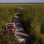
- Tuesday, July 14: The situation escalates. The MPCA issues an air quality alert covering the metro area, central counties, and the Arrowhead region. Simultaneously, authorities order the emergency closure of the BWCAW.
- Wednesday, July 15: Emergency management teams scramble to evacuate the thousands of visitors inside the BWCAW. Canadian forces complete a daring evacuation of 15 people—including 11 Minnesota teenagers—from an Ontario provincial park.
- Thursday, July 16: Smoke levels intensify, grounding aerial firefighting assets. Officials warn that the fires are entrenched and likely to burn until the arrival of autumn snows.
The Evacuation and the Firefighting Struggle
When the BWCAW was closed on Tuesday, an estimated 6,000 to 10,000 visitors were scattered across the wilderness. Karen Harrison, a spokesperson for state and federal emergency management agencies, reported that by Wednesday, teams had successfully reached approximately 90% of those individuals.
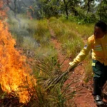
The logistical challenge of managing fire in such remote terrain is immense. Smoke density has hampered the use of aircraft, forcing crews to rely on more traditional—and slower—methods of containment. "There will be fire on the landscape until fall," Harrison stated, noting that the reality of the situation is that some fires will continue to smolder until the first snowfall of the winter.
This sentiment is mirrored in Canada, where wildfires remain a constant, looming threat. In Manitoba, the town of Lynn Lake was recently forced to evacuate as fires burned out of control, underscoring the regional nature of the crisis.
Supporting Data: A Growing Trend
The frequency of air quality alerts in Minnesota has reached an all-time high over the past five years. The Minnesota Department of Health points to a clear correlation between these alerts and the increase in hot, dry conditions across the Upper Midwest.
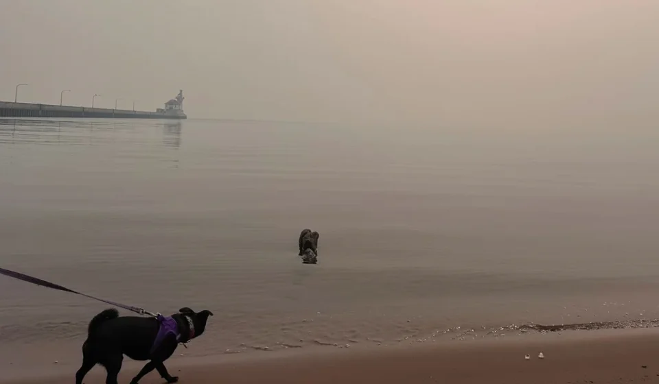
The "Great American Smokeout of 2025," as described by the Minnesota State Climatology Office, was a watershed moment. Last summer, dominant northerly and northwesterly winds funneled thick plumes of smoke from massive fires in Saskatchewan and Manitoba directly into the heart of the United States.
The National Institutes of Health (NIH) has officially labeled 2023 a "turning point" in climate history. With 46 million acres burned across North America, the scale of the destruction was unprecedented. During that time, 98% of Canada’s population was exposed to at least one day of unhealthy air, and the smoke traveled as far as Europe. For Minnesotans, this cycle of smoke—once an anomaly—has become a recurring feature of the annual calendar.
Official Responses and Meteorological Insight
State and federal agencies are working in close coordination to monitor the situation. The MPCA utilizes hourly data uploads from the National Weather Service (NWS) and maintains constant communication with the U.S. Forest Service and their Canadian counterparts at the Canadian Interagency Forest Fire Centre (CIFFC).
Despite concerns regarding federal budget cuts, the NWS Chanhassen office remains fully operational. Meteorologists continue to conduct twice-daily weather balloon launches at 6 a.m. and 6 p.m. These balloons, which ascend up to 20 miles into the atmosphere, provide critical data on humidity, temperature, air pressure, and wind patterns. Brennan Dettmann, a meteorologist at the NWS, noted that while the equipment often sustains significant damage during its journey into the upper atmosphere, the data it provides is irreplaceable for predicting where smoke plumes will travel next.
Implications for Public Health and the Future
The immediate concern for the MPCA is the health impact of the current air quality alert, which is set to run through 11 a.m. Friday. When heavy wildfire smoke interacts with ground-level ozone and other urban pollutants, the resulting air quality can be dangerous for vulnerable populations, including the elderly, children, and those with respiratory issues.
The broader implication is that the "wildland-urban interface" is expanding. As seen in the recent history of Flin Flon, Canada, where fire nearly destroyed the town, these events are no longer contained to remote forests. Local reporter Ron Dobson noted that while this summer has been relatively manageable for his region compared to last year, the threat remains constant. "They have one little road that goes for 100 kilometers," Dobson explained, referencing the extreme vulnerability of remote Canadian towns. "If that road gets cut off, they’re in trouble."
As Minnesota looks toward the remainder of the summer, the forecast is grim. Forecasters predict another 12 to 16 days of smoke from Canadian fires through the end of July and into early August.
The lesson of the last few years is clear: the climate is changing, and with it, the definition of a "normal" summer. For the residents of the North Star State, the coming months will require a heightened state of vigilance, a reliance on data-driven public warnings, and a difficult acknowledgment that the smoke, like the fire, may be a permanent guest until the snows return.
For the most current information on air quality, residents are encouraged to visit the Minnesota Pollution Control Agency website. For wildfire maps and evacuation updates, the Minnesota Incident Command System (MICS) and the Canadian Interagency Forest Fire Centre (CIFFC) provide the most comprehensive, real-time data.