























































The New Normal: Minnesota Faces Escalating Wildfire Crisis and Persistent Air Quality Alerts

For much of the early summer, Minnesotans enjoyed a rare reprieve from the stifling, acrid haze that has defined the last few wildfire seasons. The skies remained a crisp, clear blue, and the air quality stayed within healthy ranges well into July. However, that brief period of atmospheric grace came to an abrupt end this week as a combination of intense heat and lightning-induced ignitions sparked a flurry of wildfire activity across the Superior National Forest and the northern border region.
What was once considered an anomalous weather event has increasingly become a seasonal fixture. As of Thursday, more than a dozen active wildfires are burning across northern Minnesota, including three significant blazes deep within the Boundary Waters Canoe Area Wilderness (BWCAW). This flare-up has prompted immediate concern from state officials, emergency management agencies, and health experts, who warn that this is likely just the beginning of a long, smoky summer.
The Spark: A Chronology of the July Outbreak
The current crisis began in the early days of July. Following a stretch of relative calm, the atmospheric conditions shifted, bringing extreme heat and humidity to the Upper Midwest. On July 6, a potent storm system tracked across the northern reaches of the state, accompanied by intense lightning strikes. According to the Minnesota Incident Command System (MICS), those lightning strikes were the catalyst for the current outbreak.
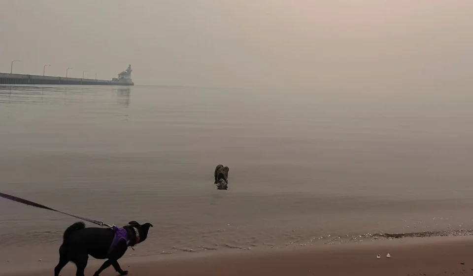
By the second week of July, the fires had gained significant traction. On Tuesday, the Minnesota Pollution Control Agency (MPCA) issued a statewide air quality alert—a move that underscores the severity of the smoke dispersion. The alert, which remains in effect through 11 a.m. Friday, blankets much of the state, including the Twin Cities metropolitan area, central Minnesota, and the Arrowhead region.
The emergency response was swift. On Tuesday, officials announced the closure of the BWCAW to protect the public. At the time of the closure, an estimated 6,000 to 10,000 visitors were navigating the wilderness area. Through a massive, coordinated effort, Superior National Forest staff managed to reach approximately 90% of those individuals by Wednesday, according to Karen Harrison, a spokesperson for state and federal emergency management agencies.
A Landscape Under Siege: The Environmental Context
The situation in Northern Minnesota is exacerbated by the broader regional climate. For years, Canadian wildfires have served as the primary driver of poor air quality in the state. Meteorologists at the MPCA and the National Weather Service (NWS) have been closely monitoring both domestic ignitions and the massive fire complexes burning north of the border.
"We had been effectively ‘spoiled’ to start the summer," noted Brennan Dettmann, a meteorologist at the NWS office in Chanhassen. Before the recent heatwave, Minnesota experienced slightly below-normal temperatures and manageable humidity levels. However, as Dettmann and his colleagues warned in late June, the El Niño pattern—coupled with long-term drought conditions—created a "tinderbox" scenario.
The geography of the region poses unique challenges for firefighting. In the BWCAW, the dense, rugged terrain makes ground-based suppression difficult. Furthermore, the persistent smoke has created visibility hazards that ground aircraft, leaving fire crews with limited options. "There will be fire on the landscape until fall," Harrison stated grimly on Thursday, "and some fire will be burning until snow cover."
The crisis is not confined to the U.S. side of the border. On Wednesday, the Royal Canadian Air Force successfully evacuated 11 Minnesota teenagers and four staff members from an Ontario provincial park located approximately 175 miles north of the border, highlighting the interconnected nature of the wildfire threat across the continent.
Supporting Data: Tracking the "Great American Smokeout"
The frequency of air quality alerts in Minnesota has reached unprecedented levels over the last five years, according to the Minnesota Department of Health. The correlation between hotter, drier summers and the increase in particulate matter in the air is now a statistical certainty.
The Minnesota State Climatology Office, in its recent Climate Journal, characterized the summer of 2025 as the "Great American Smokeout." The report noted that the majority of air quality issues were driven by prevailing northerly and northwesterly winds, which carried dense smoke plumes from the vast forests of Manitoba and Saskatchewan directly into the heart of the Midwest.
This shift in air quality dynamics is not merely local. Scientific literature, including reports from the National Institutes of Health (NIH), has identified 2023 as a global "turning point" in fire activity. That year, an estimated 46 million acres burned across North America, with smoke plumes reaching as far as Europe. During that period, 98% of the Canadian population was exposed to at least one day of hazardous smoke—a stark reminder of the scale of the threat.
Official Responses and Cross-Border Coordination
Managing this complex, cross-border issue requires a high level of inter-agency cooperation. The MPCA updates its data to the National Weather Service on an hourly basis, and regular briefings are held between forecasters in the Upper Midwest, the U.S. Forest Service, and their counterparts in Ontario, Canada.
Despite reports of federal budget constraints affecting various government sectors, the NWS office in Chanhassen remains fully operational. Meteorologists continue their twice-daily weather balloon launches at 6 a.m. and 6 p.m. These balloons, which ascend up to 20 miles into the atmosphere, provide critical real-time data on temperature, humidity, wind patterns, and air pressure—data that is essential for modeling where smoke plumes will travel next.
"The equipment gets pretty beat up," Dettmann noted, referring to the delicate sensors that often land in remote, rugged terrain after the balloons burst. Yet, this data is the backbone of the forecasting models that help the public prepare for the health impacts of wildfire smoke.
Regional Perspectives: Reports from the Frontlines
While Minnesota grapples with its current crisis, the experience of communities in Canada provides a glimpse into the volatility of the situation. In Flin Flon, a mining town on the border of Manitoba and Saskatchewan, the situation is currently described as "better than last year," largely due to localized rain.
However, local reporter Ron Dobson notes that this stability is fragile. "We’ve got rain and it’s more like a normal summer other than forest fires," Dobson said. "There are some fires further north, but if it gets really dry, then it could change. For now, it’s really good."
The lingering trauma from previous years is evident. Last summer, Flin Flon was nearly encircled by fire, forcing mass evacuations. While the city itself was spared, nearby communities like Denari Beach were devastated, and residents are still in the early stages of rebuilding. The challenge, Dobson explains, is the extreme isolation of these remote regions. "They have one little road that goes for 100 kilometers," he said. "If that road gets cut off, they’re in trouble." This summer, that reality manifested in the evacuation of Lynn Lake, the "sport fishing capital of Manitoba," due to advancing fire fronts.
Long-Term Implications: Adapting to a Changing Climate
The recurring nature of these wildfire seasons suggests that Minnesota and the surrounding regions are entering a period of permanent adaptation. The "new normal" involves not only sophisticated air quality monitoring but also a fundamental shift in how residents and visitors interact with the environment.
Implications for Public Health
The MPCA has been clear: heavy smoke, especially when combined with existing air pollution, acts as a significant health risk. For vulnerable populations, including the elderly, children, and those with respiratory issues, these air quality alerts are not just inconveniences—they are health mandates. Prolonged exposure to fine particulate matter (PM2.5) is linked to increased rates of asthma, heart disease, and other long-term ailments.
The Future of Recreation and Wilderness Management
The closure of the BWCAW serves as a precursor to future management strategies. As climate change continues to increase the probability of lightning strikes and fuel-dryness in the wilderness, the ability to maintain open access to public lands may be increasingly compromised by safety closures. State and federal authorities are likely to face growing pressure to develop more resilient infrastructure and more robust evacuation protocols for remote areas.
A Call for Preparedness
As the state moves through the latter half of the summer, the message from meteorologists and emergency managers is one of vigilance. Residents are encouraged to utilize resources such as the Canadian Interagency Forest Fire Centre (CIFFC) and local MPCA forecasts to stay informed.
The fires currently burning in the Superior National Forest and across Canada are a sobering reminder of the interconnectedness of our climate. Whether it is the smoke drifting from the boreal forests of Canada or the local ignitions sparked by a stray lightning bolt, the fire-driven future is here. For Minnesotans, the task ahead is to reconcile the enjoyment of their state’s pristine landscapes with the reality of an increasingly flammable, smoke-filled world.
As the sun sets over a hazy northern horizon, the words of Karen Harrison resonate: the fires will burn until the snow falls. Until then, the state remains on high alert, watching the wind, the sky, and the horizon for the next sign of trouble.