























































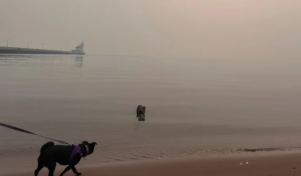

It was supposed to be a reprieve. For much of the early summer, Minnesotans enjoyed skies free of the acrid, hazy veil that has become an unwelcome seasonal trademark. But as July progressed, the atmospheric peace shattered. A series of lightning-sparked blazes in the Superior National Forest has brought the reality of wildfire season directly to the state’s northern border, signaling that Minnesota’s vulnerability to climate-driven fire events is no longer merely a byproduct of Canadian winds—it is an internal crisis.
With over a dozen active wildfires currently burning across the northern landscape, including three major blazes deep within the pristine Boundary Waters Canoe Area Wilderness (BWCAW), state authorities are bracing for a long, difficult road ahead. Meteorologists and emergency management officials warn that the current conditions are likely just the beginning of a persistent, multi-month struggle.
The Chronology of an Escalating Crisis
The current surge in fire activity can be traced back to July 6, when a volatile storm system swept through northern Minnesota. While the storm brought much-needed moisture to some areas, it also delivered a barrage of lightning strikes across the dry, timber-dense terrain of the Arrowhead region.
By the following week, the Minnesota Incident Command System (MICS) reported that these strikes had ignited more than a dozen wildfires. The situation escalated rapidly on Tuesday, when the Minnesota Pollution Control Agency (MPCA) issued a comprehensive air quality alert. The alert, covering the metro area, central counties, and the Arrowhead, remains in effect through 11 a.m. Friday.
The timing of these fires coincides with a broader shift in regional weather patterns. After a spring and early summer defined by slightly cooler temperatures and lower humidity—a period meteorologists described as "spoiled"—a stretch of hot, humid, and stagnant air settled over the Upper Midwest. This heat, combined with lingering drought conditions linked to ongoing climate patterns, turned the northern forests into a tinderbox.
Supporting Data: A New Climate Normal
The increasing frequency of air quality alerts in Minnesota is not a statistical anomaly; it is a trend line. According to the Minnesota Department of Health, the state has issued more air quality alerts due to wildfire smoke in the last five years than at any other point in recorded history.
The culprit is a combination of local ignition events and a massive, continental-scale fire environment. For years, Minnesota’s air quality issues were primarily driven by smoke drifting south from Canada or west from California. The 2025 season, however, is testing the state’s resilience on both fronts.
The Minnesota State Climatology Office, in its retrospective analysis of last summer, dubbed the event the "Great American Smokeout of 2025." The report noted that northerly and northwesterly winds consistently funneled smoke from massive, uncontrolled fires in the forests of Manitoba and Saskatchewan.
The National Institutes of Health recently identified 2023 as a "turning point" for North American fire activity, citing that 46 million acres burned across the continent that year. The scale of these fires was so vast that smoke plumes reached Europe, and nearly 98% of Canada’s population experienced at least one day of hazardous air quality. In the context of this global shift, Minnesota’s current predicament is part of a larger, systemic transformation of the boreal forest ecosystem.
Official Responses and Emergency Management
The human element of the fire response has been swift and complex. On Tuesday, officials made the difficult decision to close the BWCAW, a premier wilderness destination. At the time of the closure, estimates suggested between 6,000 and 10,000 visitors were scattered throughout the wilderness.
Karen Harrison, a spokesperson for state and federal emergency management agencies, reported that by Wednesday, search and rescue teams had successfully contacted approximately 90% of those individuals. The evacuation process has been complicated by the very conditions causing the fire.
"Smoke is making it incredibly difficult for our air support to operate," Harrison said. "Helicopters, which are vital for both reconnaissance and water drops, are often grounded by visibility issues."
The outlook provided by emergency management is grim. Because the fires are burning in remote, rugged terrain, containment is an arduous, slow-moving process. "There will be fire on the landscape until fall," Harrison stated on Thursday, noting that some of these blazes will likely burn until the first permanent snow cover arrives later this year.
In a dramatic cross-border intervention, the Royal Canadian Air Force successfully evacuated 11 Minnesota teenagers and four staff members on Wednesday from an Ontario provincial park located 175 miles north of the border. The operation highlighted the interconnected nature of the fire threat, where the safety of residents often depends on international cooperation and rapid logistical mobilization.
The View from the Front Lines: Lessons from Flin Flon
To understand the volatility of this environment, one need only look to the Canadian mining town of Flin Flon, which straddles the Manitoba-Saskatchewan border. Last summer, the city faced an existential threat as wildfires encroached on its perimeter, forcing mass evacuations and destroying nearby residential properties.
Local reporter Ron Dobson describes a fragile existence. "Last year, we were nearly wiped out," Dobson said. While this year has seen more rain and fewer direct threats, the situation remains precarious. "We have one narrow road that stretches for 100 kilometers. If that road gets cut off by fire, the entire community is effectively trapped. That is the reality of living in the boreal forest today."
The recent evacuation of Lynn Lake—Manitoba’s "sport fishing capital"—serves as a stark reminder of how quickly conditions can deteriorate. In these remote areas, limited infrastructure means that firefighting efforts are often limited to defensive postures, prioritizing the protection of life over the suppression of the fire itself.
Implications: A Vulnerable Infrastructure
The strain on resources extends beyond the firefighting crews on the ground. Meteorologists like Brennan Dettmann, from the National Weather Service (NWS) office in Chanhassen, are managing the critical task of monitoring and predicting the movement of these toxic plumes.
Despite reports of federal budget pressures on the NWS, the Chanhassen office remains fully staffed with a team of 10 to 20 meteorologists. Twice daily, at 6 a.m. and 6 p.m., the team launches weather balloons that ascend up to 20 miles into the atmosphere. These instruments provide the high-resolution data necessary to track humidity, temperature, and wind shear—variables that determine whether smoke will settle over the Twin Cities or drift harmlessly toward the Great Lakes.
"The equipment takes a beating," Dettmann noted, explaining that the balloons and their attached sensors are often lost to the elements. Yet, the data they provide is the first line of defense for public health.
Looking Forward: Living with Smoke
The implications of this summer’s fires are clear: Minnesota is no longer shielded by its northern geography. The convergence of hotter, drier summers and the increasing frequency of lightning-ignited forest fires has created a "new normal."
Public health officials are urging residents to take air quality alerts seriously. When smoke concentrations rise, the fine particulate matter—known as PM2.5—can bypass the body’s natural defenses, leading to respiratory and cardiovascular distress. The MPCA continues to coordinate with the NWS and Canadian authorities to provide the most up-to-date modeling for public consumption.
As of late July, the combination of active fires in the Superior National Forest and the continued influx of smoke from Canada suggests that the "Great American Smokeout" is far from over. For Minnesotans, the summer of 2025 will be defined by an ongoing vigil—a constant eye on the horizon, a reliance on meteorological precision, and a hard-learned lesson that the wild places of the north are increasingly, and permanently, on fire.
For those seeking real-time information, the Minnesota Incident Command System (MICS) and the Canadian Interagency Forest Fire Centre (CIFFC) remain the primary hubs for updates. As the season progresses, the ability to adapt to these shifting, smoke-filled conditions will be the most critical skill for residents across the state.