


























































It is likely just the beginning. After enjoying a reprieve from the hazy, particulate-laden skies that have plagued recent summers, Minnesota residents saw that sense of security vanish this week. As a volatile combination of extreme heat and lightning-induced ignitions took hold, the state’s pristine northern border—specifically the Superior National Forest—became a flashpoint for wildfire activity.
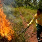
While Canadian wildfires have historically served as the primary culprit for the smoke choking the Midwest, the current crisis is homegrown. As of Thursday, more than a dozen active wildfires were burning across northern Minnesota, including three situated deep within the iconic Boundary Waters Canoe Area Wilderness (BWCAW). This surge in fire activity marks a sobering reminder that the "new normal" of climate-driven instability is firmly entrenched in the Upper Midwest.
The Chronology of an Escalating Crisis
The current crisis traces its origins back to July 6, when a volatile weather system swept through the region, bringing with it a barrage of lightning strikes. In the tinder-dry conditions of the northern forests, these strikes acted as ignition points, sparking a series of fires that officials have struggled to contain.
For the first half of July, Minnesota had been, as National Weather Service (NWS) meteorologist Brennan Dettmann put it, “pretty spoiled.” The state enjoyed temperatures slightly below normal and manageable humidity levels. However, that temperate window slammed shut as a sustained stretch of heat and humidity settled over the state, providing the fuel necessary to turn minor lightning strikes into widespread infernos.
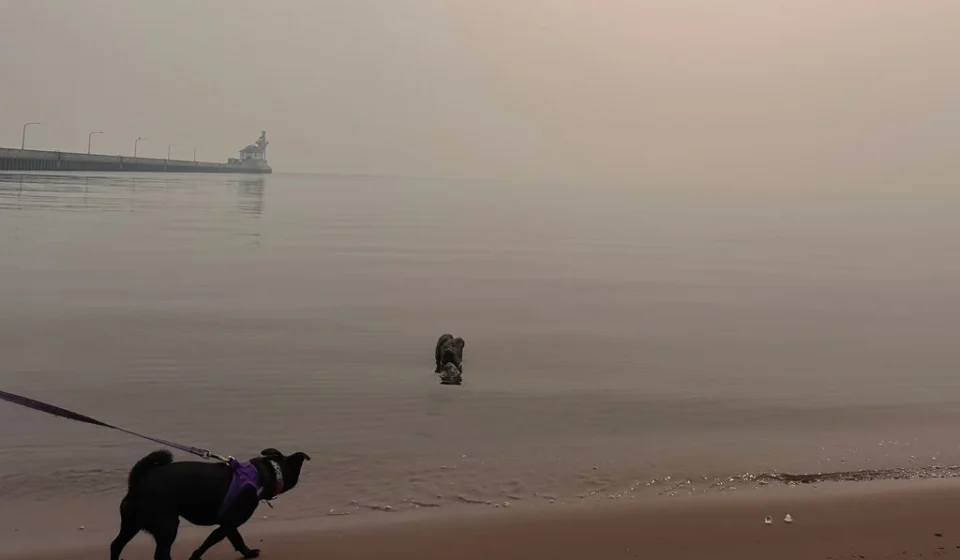
By Tuesday, the situation had deteriorated enough for the Minnesota Pollution Control Agency (MPCA) to issue a sweeping air quality alert. Covering much of the state, including the Twin Cities metro area, central counties, and the Arrowhead region, the alert remains in effect through 11 a.m. Friday. The MPCA warned that the heavy smoke, interacting with existing air pollutants, creates a significant health hazard, particularly for vulnerable populations.
Supporting Data and Historical Context
The frequency of these events is not a statistical anomaly but a trend. Over the last five years, the Minnesota Department of Health has tracked an unprecedented increase in air quality alerts directly attributable to wildfire smoke. This shift represents a departure from the air quality challenges of the past, which were often localized or linked to industrial emissions.
The Minnesota State Climatology Office, in its recent Climate Journal, went so far as to label the summer of 2025 the “Great American Smokeout.” The report noted that the majority of these air quality issues were driven by northerly and northwesterly winds, which acted as a conveyor belt, sweeping smoke from massive, persistent fires in the forests of Manitoba and Saskatchewan directly into the heart of the U.S.
The year 2023 is frequently cited by researchers at the National Institutes of Health (NIH) as a "turning point" in this atmospheric trend. That year, an estimated 46 million acres burned across North America. The impact was global; smoke reached as far as Europe, and 98% of Canada’s population was exposed to at least one day of unhealthy air quality.
While Minnesota was previously more concerned with smoke drifting south from Canadian fires, it also has a history of being affected by western wildfires. In 2020, for instance, it was the smoke from California’s catastrophic wildfire season that dominated the Minnesota sky. Now, the state faces a two-front battle: managing local ignitions while remaining in the direct path of the Canadian “smoke corridor.”
Official Responses and Tactical Challenges
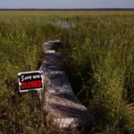
The response to the current crisis has been swift but hampered by the sheer scale of the terrain. On Tuesday, officials made the difficult decision to close the BWCAW to all visitors. At the time of the closure, between 6,000 and 10,000 recreationists were estimated to be inside the wilderness area. According to Karen Harrison, a spokesperson for state and federal emergency management agencies, forest staff had successfully contacted approximately 90% of those individuals by Wednesday.
The firefighting effort itself is currently engaged in a race against the elements. Smoke density has reached such critical levels that it has grounded the aviation assets—specifically helicopters—that are essential for suppressing fires in the remote, roadless wilderness.
"There will be fire on the landscape until fall," Harrison stated on Thursday, noting that the reality of the situation involves managing fires that will likely continue to smolder until the arrival of the first heavy winter snows.
Internationally, the crisis has required coordination. On Wednesday, the Royal Canadian Air Force successfully evacuated 11 Minnesota teenagers and four staff members who had been caught near wildfires in an Ontario provincial park, roughly 175 miles north of the Minnesota border.
The View from the Frontlines: A Reporter’s Perspective
The volatility of the northern forest is perhaps best illustrated by the experience of Flin Flon, a mining town straddling the Manitoba-Saskatchewan border. Local reporter Ron Dobson described a scenario that feels precarious even when the immediate situation seems calm.
“We’ve got rain, and it’s more like a normal summer other than forest fires,” Dobson said. “There are some fires further north, but if it gets really dry, then it could change.”
Last year, Flin Flon was nearly engulfed by fire, with residents forced to evacuate as flames approached the city limits. While the town survived, neighboring communities like Denari Beach were not as fortunate, with properties destroyed and long-term recovery efforts still underway.
Dobson highlighted a critical vulnerability: infrastructure. In remote regions, there is often only a single road for hundreds of kilometers. If that artery is severed by fire, both escape routes for residents and supply lines for firefighters are effectively erased. This summer, that reality forced the total evacuation of Lynn Lake, a community historically known as the “sport fishing capital of Manitoba.”
Implications for the Future
As the climate continues to warm, the meteorological conditions that foster these "smoke-filled summers" are expected to become more frequent. The NWS office in Chanhassen remains a critical node in this monitoring effort. Despite ongoing discussions regarding federal budget cuts, meteorologists continue to maintain a rigorous schedule, including twice-daily weather balloon launches at 6 a.m. and 6 p.m.
These balloons, which ascend as high as 20 miles into the atmosphere, provide the data—temperature, pressure, wind speed, and humidity—that allows agencies to predict where the smoke will travel next. It is a high-tech effort to combat an increasingly low-tech, raw threat: the uncontrollable burning of the North American wilderness.
The implications for Minnesotans are clear: the summer ritual of checking the air quality index (AQI) alongside the temperature is no longer a temporary annoyance. It is a permanent facet of life in the Great Lakes region. As the state moves into the latter half of the summer, the forecast calls for 12 to 16 additional days of smoke-heavy air, with the potential for more depending on the behavior of fires in Canada and the persistence of the current heat dome.
The state, federal, and Canadian agencies are coordinating through platforms like the Minnesota Incident Command System (MICS) and the Canadian Interagency Forest Fire Centre (CIFFC) to provide real-time updates. However, as the fires in the Boundary Waters continue to grow, it is evident that technology and data can only do so much to mitigate the impacts of a changing climate. For now, the people of Minnesota are left to wait, watch the horizon, and hope for the rain that finally brings the season to a close.