

























































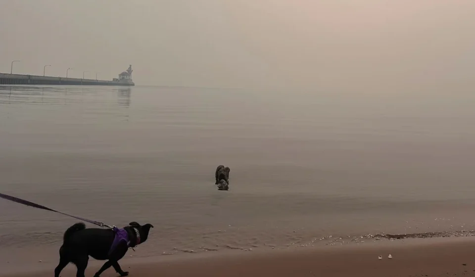

For much of the early summer, Minnesotans enjoyed a reprieve from the acrid, hazy skies that have become an unwelcome hallmark of the season in recent years. Crisp, clear air defined the state well into July, offering a brief sense of normalcy. However, that tranquility vanished this week as a combination of intense heat and a series of lightning strikes ignited more than a dozen wildfires across northern Minnesota, including several within the iconic Boundary Waters Canoe Area Wilderness (BWCAW).
This latest crisis is not an isolated event; it represents a volatile intersection of local climate conditions and the persistent, continent-wide trend of increasing wildfire activity. As smoke from both local blazes and the vast, smoldering expanses of Canada chokes the air, state officials are sounding the alarm on a trend they fear is only the beginning of a long, arduous summer.
The Spark: A Chronology of the July Outbreak
The shift in Minnesota’s air quality was both sudden and dramatic. After a period of relative atmospheric stability, a storm system pushed through the northern border regions on July 6. According to the Minnesota Incident Command System (MICS), this weather event brought a barrage of lightning strikes to the tinder-dry forests of the Superior National Forest.
By Thursday, the situation had escalated significantly. More than a dozen active wildfires were reported, with three burning directly inside the Boundary Waters Canoe Area Wilderness. The rapid development of these fires forced immediate action from authorities, who moved to close the BWCAW on Tuesday to ensure public safety.
At the time of the closure, an estimated 6,000 to 10,000 visitors were scattered across the wilderness area. In a massive logistical undertaking, Superior National Forest staff worked around the clock to notify and evacuate campers. By Wednesday, officials estimated they had reached 90% of those within the affected zones. The evacuation effort, however, remains complicated by the very elements that fueled the fires: dense, low-hanging smoke.
"Smoke is making it difficult for helicopters to fly, and fires in the wilderness are spreading despite firefighting efforts," said Karen Harrison, a spokesperson for state and federal emergency management agencies. She offered a sobering prognosis for the weeks ahead: "There will be fire on the landscape until fall, and some fire will be burning until snow cover."
The threat is not confined to Minnesota borders. The Royal Canadian Air Force was forced to intervene on Wednesday, successfully evacuating 11 Minnesota teenagers and four staff members from a wilderness camp in an Ontario provincial park, located roughly 175 miles north of the border, as fires threatened their route to safety.
Supporting Data: An Unprecedented Pattern
The data paints a concerning picture of a changing climate. According to the Minnesota Department of Health, the state has issued more air quality alerts due to wildfire smoke in the last five years than at any other time in recorded history. These alerts, driven by hotter, drier conditions, have fundamentally altered the experience of a Minnesota summer.
The Minnesota Pollution Control Agency (MPCA) has been tracking this trend closely. Meteorologist Matt Taraldsen noted in late June that the agency had been monitoring fire activity in Canada, compounded by long-term drought predictions associated with El Niño patterns. These warnings were echoed by Brennan Dettmann, a meteorologist at the National Weather Service (NWS) office in Chanhassen, who observed that the state had been "pretty spoiled" at the start of the summer with below-normal temperatures and lower humidity—a pattern that collapsed as the current heat wave took hold.
The scope of the problem is continental. The National Institutes of Health has labeled 2023 a "turning point" in climate history, noting that 46 million acres burned that year alone. The smoke was so pervasive that it reached European shores, and nearly 98% of Canada’s population was exposed to at least one day of unhealthy air quality.
The Minnesota State Climatology Office, in its latest Climate Journal, characterized last summer as the "Great American Smokeout of 2025," noting that persistent northerly and northwesterly winds acted as a conveyor belt, sweeping smoke from massive fires in Manitoba and Saskatchewan directly into the heart of the Midwest.
Official Responses and Monitoring
In response to the deteriorating air quality, the MPCA issued an alert running through 11 a.m. Friday, covering the metro area, central counties, and the Arrowhead region. The agency warned that the combination of heavy smoke and existing air pollution creates a significant health risk, particularly for vulnerable populations.
Monitoring these conditions is a multi-agency effort that transcends national borders. MPCA meteorologists upload data to the NWS on an hourly basis, and daily consultations are held between forecasters in the Upper Midwest, the U.S. Forest Service, and their counterparts in Ontario.
Despite reports of federal budget constraints affecting the NWS, local operations remain robust. The Chanhassen office continues its critical twice-daily weather balloon launches. These balloons, which ascend up to 20 miles into the atmosphere, provide the essential raw data—humidity, temperature, wind speed, and pressure—required to feed the predictive models that warn Minnesotans of incoming smoke. While the equipment often sustains damage or is lost during the descent, its role in modern fire weather forecasting is irreplaceable.
A View from the Front Lines: Lessons from Flin Flon
To understand the broader context of the wildfire threat, it is helpful to look toward Canada, where many of the smoke plumes originate. In Flin Flon, a mining town straddling the border of Manitoba and Saskatchewan, the situation serves as a stark warning of what happens when fire meets infrastructure.
Local journalist Ron Dobson reports that while this summer has been relatively "normal" for his town due to recent rains, the memory of last year’s devastation remains fresh. The city was nearly destroyed by fire, and many residents are still in the process of rebuilding properties in nearby Denari Beach.
Dobson highlights the unique vulnerability of remote northern regions: "They have one little road that goes for 100 kilometers. If that road gets cut off, they’re in trouble." This summer, that reality became apparent again when wildfires forced the evacuation of Lynn Lake, Manitoba, a town renowned for its sport fishing industry. The isolation of these regions makes both firefighting and mass evacuations an exercise in extreme difficulty.
Implications: The New Normal
The implications of this summer’s fires extend far beyond the immediate need for evacuations and air quality alerts. The environmental shift toward hotter, drier summers in the northern latitudes suggests that wildfire management will require a permanent, year-round focus.
The "Great American Smokeout" phenomenon is no longer a rare anomaly; it is becoming a seasonal expectation. As forests continue to dry out and lightning frequency remains a constant, the resilience of the Boundary Waters and surrounding ecosystems is being tested as never before.
For the average Minnesotan, the takeaway is clear: the air quality apps on their phones and the official alerts from the MPCA are now essential tools for navigating the summer months. As officials continue to battle the fires in the Superior National Forest, the broader, more complex challenge remains—adapting to a changing climate where the threat of smoke and flame is, quite literally, always just over the horizon.
For those seeking real-time information, state and federal agencies continue to update their portals, including the Canadian Interagency Forest Fire Centre (CIFFC) for regional fire maps and the MPCA for air quality status updates. As the summer progresses, vigilance will remain the best defense against a season that has proven, yet again, to be as unpredictable as it is hazardous.